Earth Surface Dynamics with RiverTools, University of Geneva
RiverTools is frequently used for teaching, as well as research. In March 2013, Sébastien Castelltort (University of Geneva, Switzerland) and Boris Kaus (University of Mainz, Germany) used it to teach Part 2 of a hands-on TOPOMOD Short Course for students at the University of Mainz. The course title was Numerical Modelling and Analysis of Surface Processes. Rivix Software donated a temporary lab license to support the course. Course materials are available here. Sébastien Castelltort — a Professor in Comparative Sedimentology and Surface Processes at University of Geneva — is a long-time user of RiverTools. He leads the Earth Surface Dynamics group at the University of Geneva, Switzerland. He is also Editor of Basin Research, Associate Editor of Earth Surface Dynamics and a member of the Swiss Geomorphological Society. Professor Castelltort uses RiverTools for both teaching and research projects. Some of his recent publications that made use of RiverTools are:
For greater flexibility in his work, Prof. Castelltort takes advantage of the ability to write his own scripts in IDL (Interactive Data Language) that call the low-level RiverTools commands that are documented in the RiverTools Command Reference. This allows him to utilize batch processing and customized scripting. Says Castelltort: "There is so much I've done using RiverTools with IDL but never published..." 
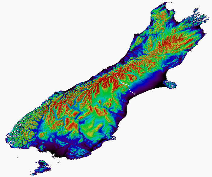
Shaded relief image for the South Island of New Zealand, showing the streamline of the main channel of the Rangitata River, a braided river. 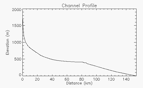
Longitudinal elevation profile for the main channel of the Rangitata River. |
|
Copyright (c) 1998-2024, RIVIX, LLC. All rights reserved. Last update: June 5, 2024. Privacy statement. |